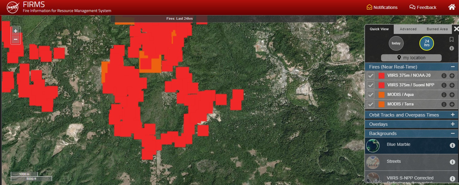
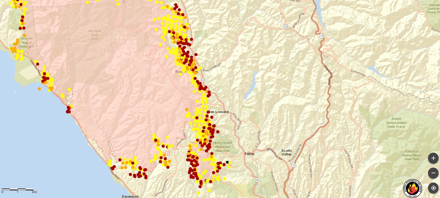
The Fire Information for Resource Management System (FIRMS) distributes Near Real-Time (NRT) active fire data within 3 hours of satellite observation from both the Moderate Resolution Imaging Spectroradiometer (MODIS) and the Visible Infrared Imaging Radiometer Suite (VIIRS).
Read More
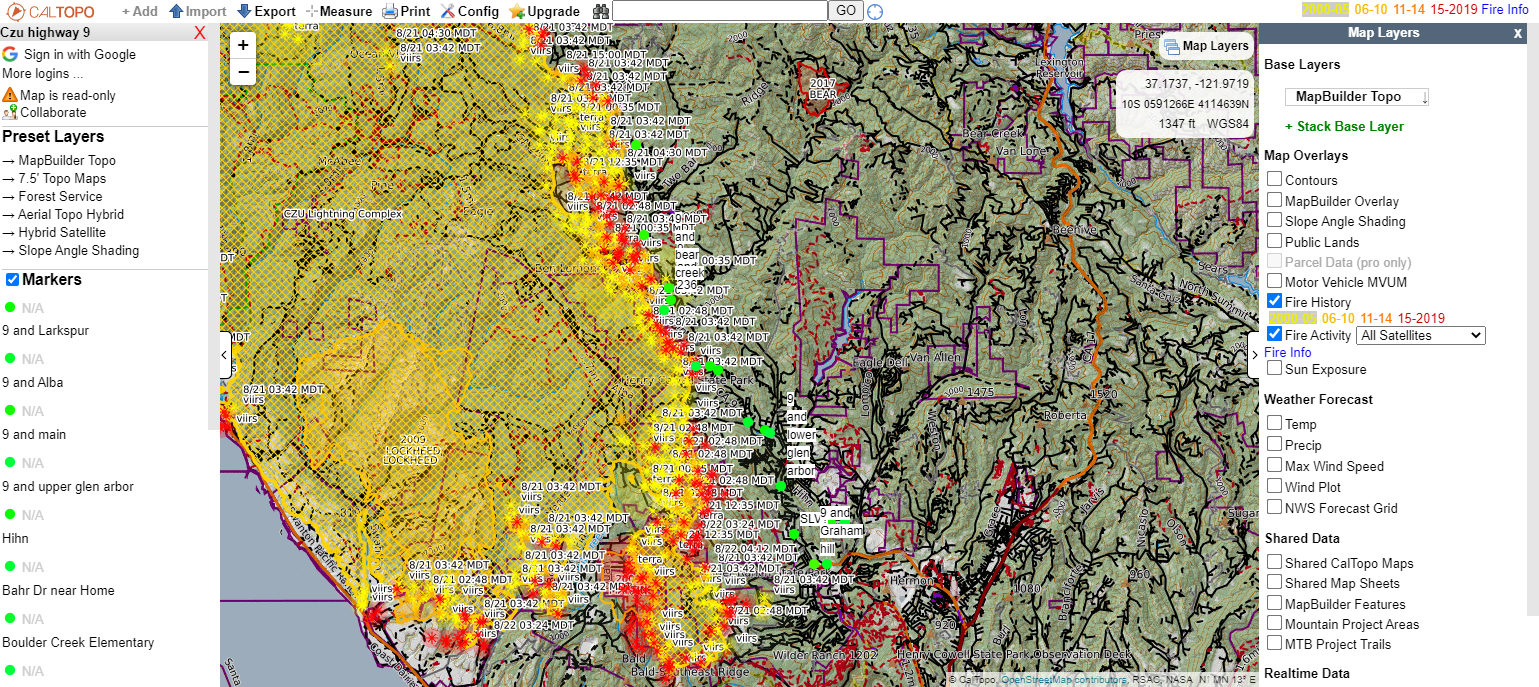
View the map here: CALTOPO Highway 9 Fire Map From the CALTOPO.com website: CalTopo is the creation of Matt Jacobs as a solution to some challenges facing search and rescue members. Matt recognized some of these problems as a member of a search and rescue organization in the San Francisco Bay area in 2010. CalTopo was launched as a tool…
Read More
National Interagency Fire Center Satellite Map with Fire Perimeter https://maps.nwcg.gov/sa/?fbclid=IwAR3673fqT99dMyV5b9jHJL-Auv83Q8XyaoyNSGUQHVcI2DTY3DlLREkcbTg#/%3F/EditLayerFireWeather/37.1018/-122.1105/12
Read More