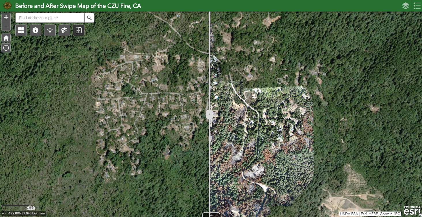
Deep in the Zonehaven
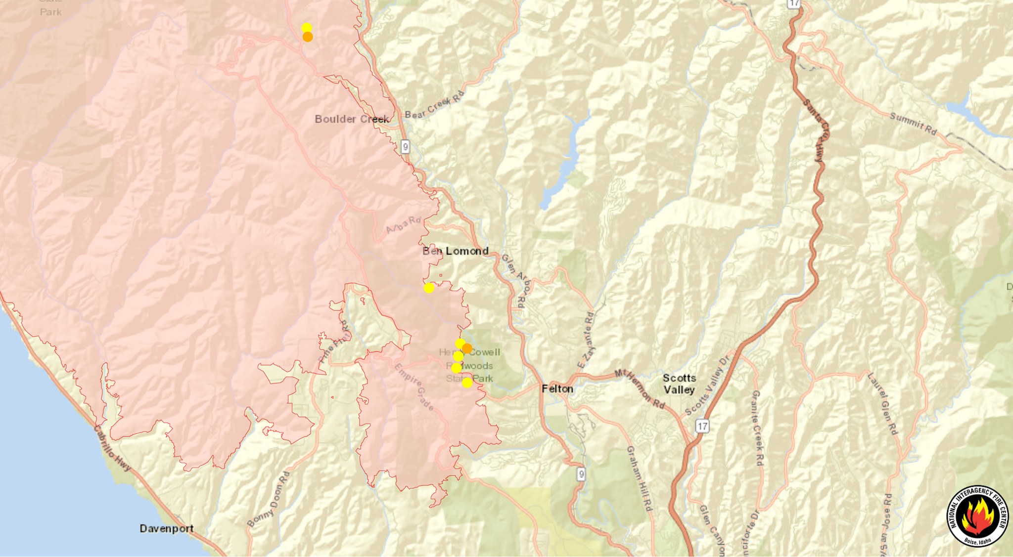
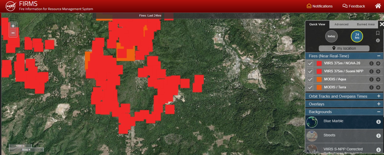
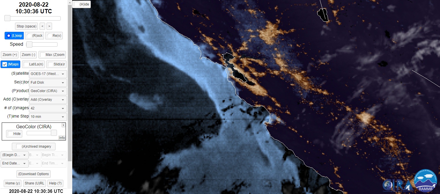
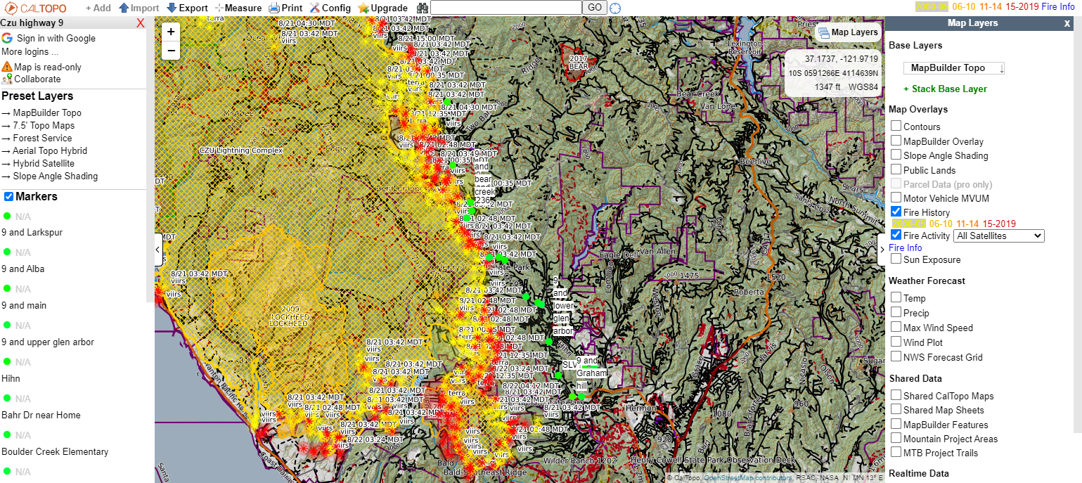
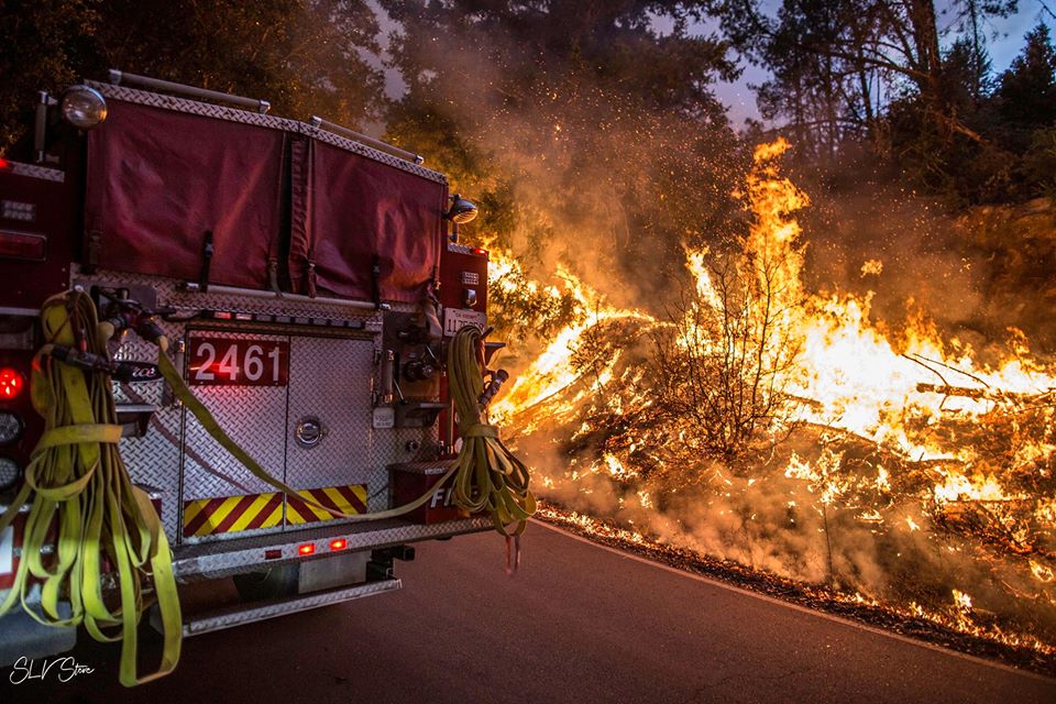
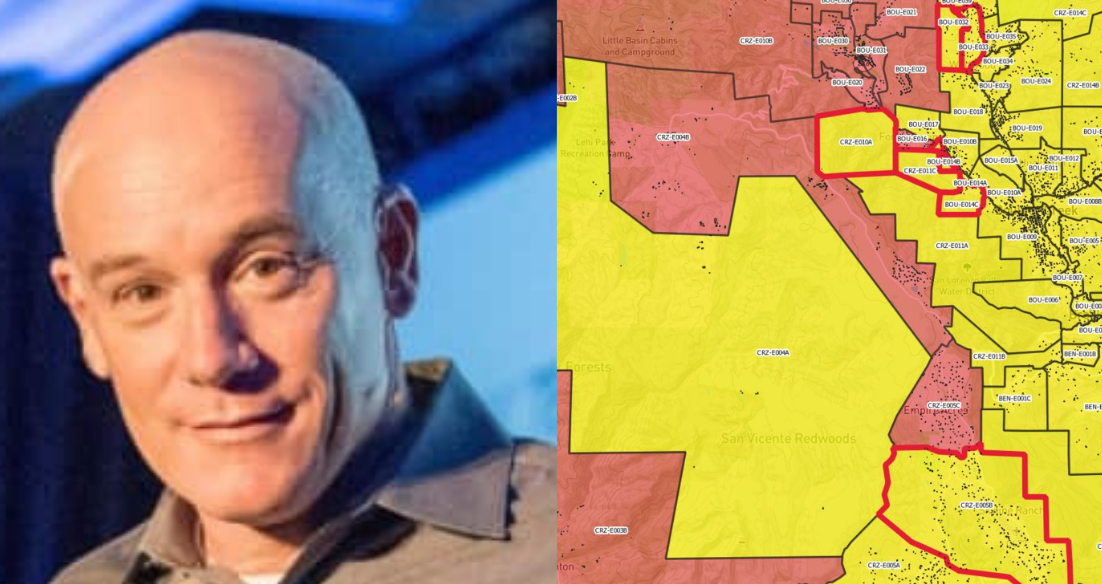
Charlie Crocker founded Zonehaven, the evacuation planning and support tool that kept us glued to our phones during the CZU Lightning Complex Fire in the San Lorenzo Valley and Santa Cruz Mountains region
Read More