Fire Map August 27, 2020
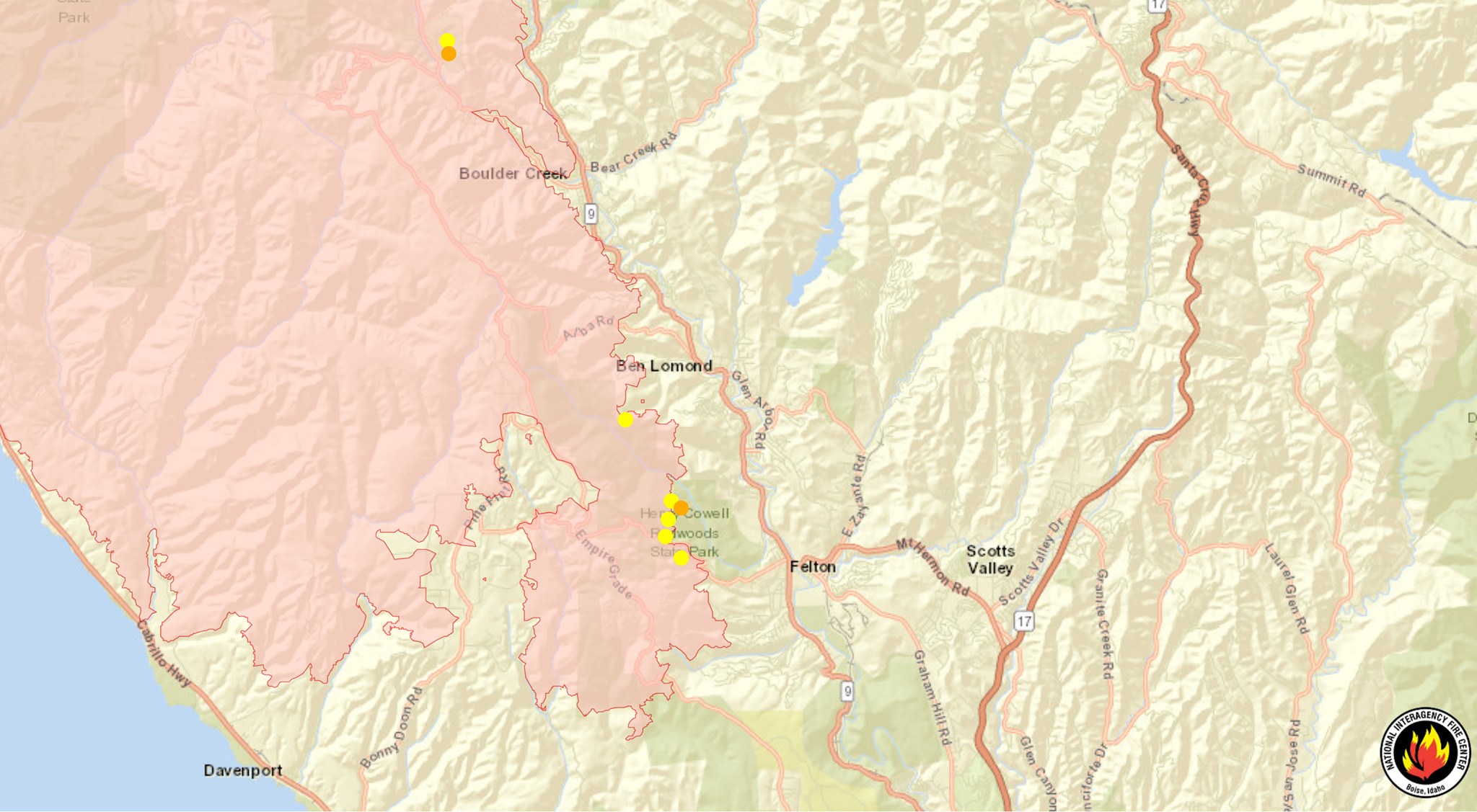
Here is the National Interagency Fire Center Satellite Map with Fire Perimeter, Thursday, August 27, 2020. The CZU August Lightning Complex fire has burned 81,333 acres and is 21% contained.
590 structures damaged
61 structures damaged
1,982 personnel fighting
Click the link to interact with the map in real time:
Low overnight winds, increased humidity and effective firing operations helped firefighters hold and bolster containment lines on the CZU Lightning Complex. An infrastructure group is working to open roads, mitigate hazard trees and restore utilities. Damage inspection continues where fire activity has diminished and it is safe to do so. The number of destroyed structures reflected may change as teams continue to make progress, damage inspection is now 60% complete. Repopulation of residents affected by evacuations will continue as conditions permit. As residents begin to return home, remember to drive carefully as fire crews and emergency personnel are still working in the area. There are approximately 74,000 residents evacuated..
#CZUAugustLightning#CZULightningComplex
The San Lorenzo Valley Post is your essential guide to life in the Santa Cruz Mountains. We're dedicated to delivering the latest news, events, and stories that matter to our community. From local government to schools, from environmental issues to the arts, we're committed to providing comprehensive and unbiased coverage. We believe in the power of community journalism and strive to be a platform for diverse voices.