San Lorenzo Valley Groundwater Basin and Water Rights
By Mary Andersen
During the recent community discussion on a potential consolidation between SLV and Scotts Valley water districts, there were statements made that “we all drink from the same source.” While we are all part of the greater watershed, a close look at specifics yields a different and more accurate picture.
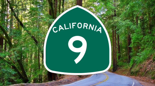
The Santa Margarita Groundwater Basin is a triangle shaped underground formation with the three points on the triangle in the following locations: Highway 9 south of Felton at the hairpin curve, Highway 236 outside of Boulder Creek, and East of Scotts Valley. All of the SLVWD and SVWD wells are in this triangle.
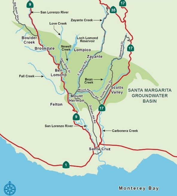
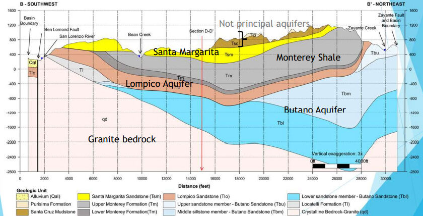
However, the Santa Margarita Groundwater Basin is composed of multiple aquifers at varying depths. The top aquifer is the Santa Margarita. Further down is the Lompico aquifer, and even further down – to what some call “ancient water” – is the Butano aquifer.
A Deeper Comparison Between the Two Districts
Scotts Valley does not use surface water at all. Scotts Valley’s wells tap into the Lompico (about 60% of their water) and Butano (about 40% of their water) aquifers. The Scotts Valley wells that tap into the Butano are almost 2,000 feet deep – just shy of ½ a mile. These deeper wells are much more expensive to develop and maintain.
By contrast, SLVWD’s wells serving its “North” area are typically 150 to 300 feet deep and tap into water from the top aquifer – the Santa Margarita. The wells serving the “South” area tap into the Lompico aquifer at depths of 500 to 800 feet. The Lompico aquifer is the sole intersection where SLVWD and SVWD actually “drink from the same source.” SLVWD does not tap into the “ancient water” in the deepest aquifer – the Butano – at all.
Water Rights
All of the surface sources in the “North” System are “pre-1914” water rights. Pre-1914 water rights are incredibly valuable to the San Lorenzo Valley. 1914 was the first date upon which California created a formal regulatory permitting framework and process for surface water rights. To quote the State Water Control Resources Board, “Although pre- and post-1914 appropriative rights are similar, post-1914 rights are subject to a much greater degree of scrutiny and regulation by the Board.” In other words, pre-1914 water rights are much broader in how they can be used, meaning this provides SLVWD with a lot of operational flexibility, particularly in light of California’s goal to stabilize and recharge its groundwater. Nominally, these water rights do not have any legal limits on the amount of water that can be extracted. But it is in our best interests not to use any more than we need to. The SLVWD concluded a multi-year study in 2018 that demonstrated that current use of this water did not impact the environment further downstream, including impacts to fish populations.
The Santa Margarita Groundwater Agency (SMGWA) was established to achieve sustainable groundwater conditions in the Santa Margarita Groundwater Basin. SLV and Scotts Valley are members of the SMGWA. The key is this: within the context of SMGWA goals, excess water from pre-1914 surface sources could be sold to Scotts Valley Water District, allowing them to “rest their wells” and stabilize and recharge their area of the Santa Margarita Basin, assuming that all parties agree that that is a proper path forward. SLVWD’s wells serving the “North” and “South” operating areas are likewise permitted and currently have no restrictions on the amount of water that can be extracted.
Conversely, the “Felton” operating area permits date back to the 1920s and 30s, meaning that SLVWD operates this area under different restrictions, including the amount of water that can be extracted. That limit is currently greater than the amount currently needed to serve the Felton operating area. While the “Felton” surface water sources are all robust, under the current permit, water from surface sources in “Felton” cannot be exported to any other area under normal operating conditions.
| “Felton” | “North” | “South” |
| Felton, Felton Empire Grade, Felton Grove, San Lorenzo Ave and El Solyo Heights | Boulder Creek, North Boulder Creek, Brookdale, Ben Lomond, Lompico and Zayante | Scotts Valley areas of Lockewood Lane, Whispering Pines, Hidden Glen and Manana Woods |
SLV Water District’s operating areas
Loch Lomond Reservoir
Finally, there’s a little known but very significant strategic untapped surface water source available to the SLVWD: an allocation of 313 acre-feet (102 million gallons) per year from Loch Lomond Reservoir. SLVWD helped pay for the construction of the dam and a court case finalized the annual allocation. The 313 acre-feet allocation is equivalent to about 20% of the water SLVWD provided to its entire customer base (“Felton”, “North”, and “South”) in the year July 2019 to June 2020. Clearly, for the SLVWD, this represents an enormous amount of water. SLVWD has not used this allocation since the late 1970s when more stringent and expensive treatment requirements were instituted for raw river water. But the raw water pipe from Loch Lomond to Santa Cruz is very close to SLVWD’s Felton infrastructure making the interconnection straightforward should the district wish to do that at some point in the future.
The district also carries several legacy water rights that are not currently active, including the water rights obtained as a result of the Lompico County Water District merging into SLVWD.
For more information about regional water rights: waterrightsmaps.waterboards.ca.gov
Additional background on California water rights: waterboards.ca.gov/waterrights/board_info/water_rights_process.html
More on the Santa Margarita Groundwater Agency’s activities: slvpost.com/santa-margarita-groundwater-agency
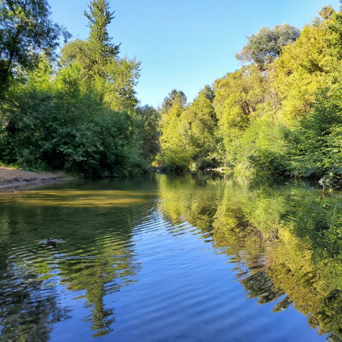
Featured photo of the San Lorenzo River in Ben Lomond, CA by Mary Andersen
The San Lorenzo Valley Post is your essential guide to life in the Santa Cruz Mountains. We're dedicated to delivering the latest news, events, and stories that matter to our community. From local government to schools, from environmental issues to the arts, we're committed to providing comprehensive and unbiased coverage. We believe in the power of community journalism and strive to be a platform for diverse voices.